• Home
  • Search
  • Browse Collections
  • My Account
  • About
  • DC Network Digital Commons Network™
Skip to main content
  • linfield university
  • Home
  • About
  • FAQ
  • My Account
DigitalCommons@Linfield DigitalCommons@Linfield

Home > Land Use Maps

Land Use Planning Maps: David Adelsheim Collection

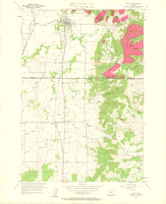
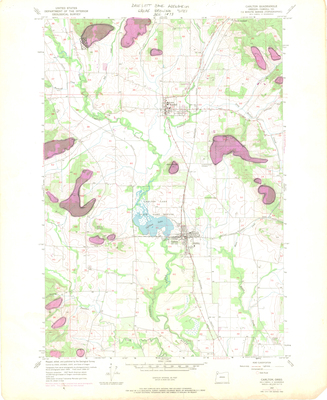
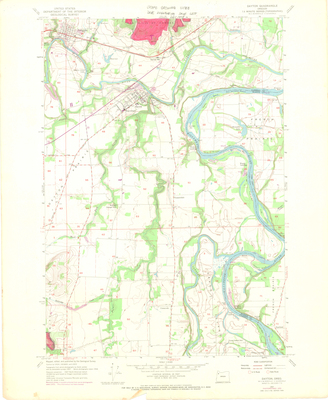
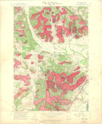
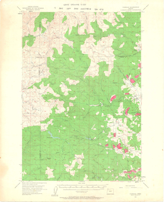
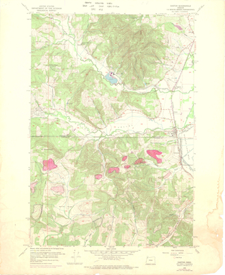
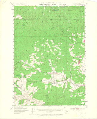
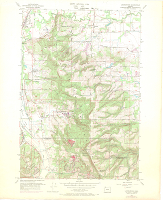
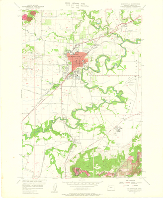
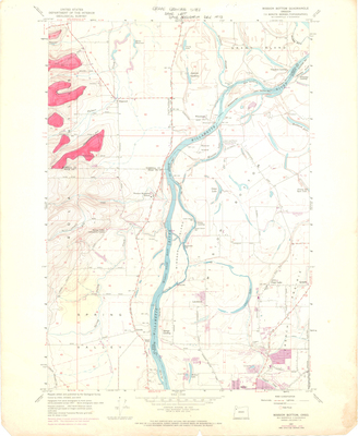
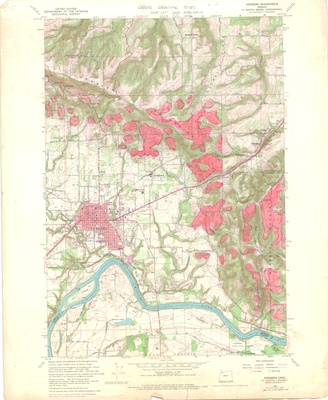
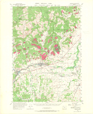
In 1973 Oregon passed two ground-breaking pieces of legislation, Senate Bills 100 and 101. These bills established the Oregon Department of Land Conservation and Development and required the creation of statewide planning goals and the protection of designated farmland. Pioneer vintners David Adelsheim and David Lett, along with others in the wine-growing community, seized on the opportunity to designate and protect future vineyard sites by lobbying county planning committees to restrict residential growth in the areas the men believed would be profitable. These maps served as a visual aid for Adelsheim and Lett during those meetings and are a reminder of how much work these men put in to ensure the future of their industry. Note that the areas they determined to be good vineyard sites are highlighted in pink. Adelsheim, Lett, and others made the case that it was not only the low-level lands of the Willamette Valley that should be considered for agricultural purposes.

Printing is not supported at the primary Gallery Thumbnail page. Please first navigate to a specific Image before printing.

Follow

Switch View to List View Slideshow
 
  • Amity Quadrangle, Oregon by David Adelsheim and David Lett

    Amity Quadrangle, Oregon

  • Carlton Quadrangle, Oregon by David Adelsheim and David Lett

    Carlton Quadrangle, Oregon

  • Dayton Quadrangle, Oregon by David Adelsheim and David Lett

    Dayton Quadrangle, Oregon

  • Dundee Quadrangle, Oregon by David Adelsheim and David Lett

    Dundee Quadrangle, Oregon

  • Fairdale Quadrangle, Oregon by David Adelsheim and David Lett

    Fairdale Quadrangle, Oregon

  • Gaston Quadrangle, Oregon by David Adelsheim and David Lett

    Gaston Quadrangle, Oregon

  • Grand Ronde Quadrangle, Oregon by David Adelsheim and David Lett

    Grand Ronde Quadrangle, Oregon

  • Laurelwood Quadrangle, Oregon by David Adelsheim and David Lett

    Laurelwood Quadrangle, Oregon

  • McMinnville Quadrangle, Oregon by David Adelsheim and David Lett

    McMinnville Quadrangle, Oregon

  • Mission Bottom Quadrangle, Oregon by David Adelsheim and David Lett

    Mission Bottom Quadrangle, Oregon

  • Newberg Quadrangle, Oregon by David Adelsheim and David Lett

    Newberg Quadrangle, Oregon

  • Sheridan Quadrangle, Oregon by David Adelsheim and David Lett

    Sheridan Quadrangle, Oregon

  • Sherwood Quadrangle, Oregon by David Adelsheim and David Lett

    Sherwood Quadrangle, Oregon


Search

Advanced Search

  • Notify me via email or RSS

Links

  • Oregon Wine History Archive

Browse

  • Collections
  • Disciplines
  • Authors

Author Corner

  • Why Publish in DC@Linfield?
  • Why Does Open Access Matter?
  • Open Access Guide
  • Policies & Submission Guidelines
  • Submit Research
  • Author FAQ

Gallery Locations

  • View gallery on map
  • View gallery in Google Earth
 
Elsevier - Digital Commons

Home | About | My Account | Accessibility Statement

Privacy Copyright