
Preview
Creation Date
Winter 1973
Disciplines
Viticulture and Oenology
Description
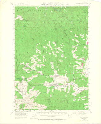
This is a map of the Grand Ronde Quadrangle. The potential vineyard sites are highlighted in pink. These maps were created to preserve certain locations from residential growth.
Recommended Citation
Adelsheim, David and Lett, David, "Grand Ronde Quadrangle, Oregon" (1973). Land Use Planning Maps: David Adelsheim Collection. Image. Submission 7.
https://digitalcommons.linfield.edu/land_use_maps/7

Comments
For more information on David Adelsheim, visit the Adelsheim Vineyard website.